
Determining Wind Speed – DIY Motorised Louvred Roof System
Selection Procedure
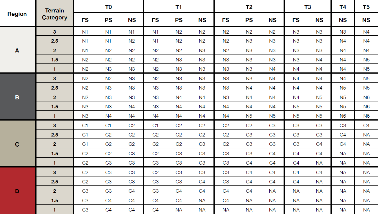
To identify a Wind Classification for a proposed structure, four key variables must be determined:
NOTE: This is an approximate method for estimating wind speeds for the assessment of wind classifications. For exact values, refer to Australian Standard AS/NZS1170.2:2011.NOTE: This is an approximate method for estimating wind speeds for assessment of wind classifications. For exact values, refer to Australian Standard AS/NZS1170.2:2011.
Region Classification
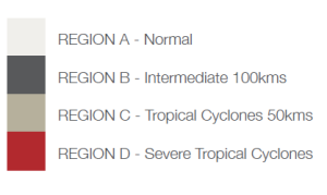
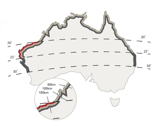
Regions are marked with the letters A, B, C, and D. Coastal region boundaries are smooth lines set in from a smoothed coastline by 50, 100, 150, and 200km. Islands within 50km of the coast are designated in the same region as the adjacent coast.
Cyclone Testing on Vivid Louvred Roof from James Cook University
Design Gust Wind Speeds
| Wind Class | Serviceability limit state (Vs) | Ultimate limit state (VR) |
|---|---|---|
| N1 | 28 m/s | 34 m/s |
| N2 | 33 m/s | 41 m/s |
| N3 | 36 m/s | 50 m/s |
| N4 | 45 m/s | 61 m/s |
| N5 | 50 m/s | 66 m/s |
| Wind Class | Serviceability limit state (Vs) | Ultimate limit state (VR) |
|---|---|---|
| C1 | 32 m/s | 50 m/s |
| C2 | 39 m/s | 61 m/s |
| C3 | 47 m/s | 74 m/s |
| C4 | 55 m/s | 86 m/s |
| C4 | 55 m/s | 86 m/s |
Terrain Category
Wind speed at a structure is influenced by the terrain it flows over as it approaches. Terrain categories are defined as:

Category 1: Exposed open terrain with few/no obstructions (e.g., flat plains, rivers, coastal areas under 10km).

Category 1.5: Open water surfaces (e.g., seas, lakes, bays extending >10km in wind direction).

Category 2: Open terrain with grasslands and well scattered obstructions (1.5–6m tall, max two per hectare).

Category 2.5: Terrain with a few trees or isolated obstructions (e.g., developing outer urban areas).

Category 3: Terrain with many closely spaced obstructions (3–10m tall, e.g., suburban housing).
Topographic Effect
The topographic classification determines how the location of a structure—such as on a hill, ridge, or escarpment—affects the wind speed it experiences. This depends on the height and slope of the hill, ridge, or escarpment.
Key Points
Topographic Effect (MT)
| Topographic Classifications | Factor |
| T0 | 1.00 |
| T1 | 1.10 |
| T2 | 1.20 |
| T3 | 1.30 |
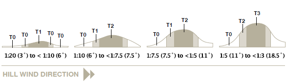
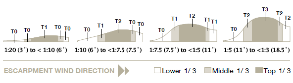
NOTE: Diagrams suitable for hill or escarpment heights not exceeding 30m. Refer AS4055:2011 for details if outside of these requirements.
Design Factors
These factors are defined in accordance with AS/NZS1170.2:2011 for a 500-year design return period and average 9m height of the main structure.
NOTE: A 5% allowance has been used when allocating the wind classification.
Terrain Categories (MZ, cat)
| Terrain Category | Regions A, B, C and D |
| 1 | 1.05 |
| 1.5 | 0.98 |
| 2 | 0.91 |
| 2.5 | 0.87 |
| 3 | 0.83 |
Shielding Factor
Shielding classification accounts for nearby structures that reduce wind speed. Based on the density of surrounding buildings or vegetation:
NS (No Shielding)

PS (Partial Shielding)

FS (Full Shielding)

Wind Speed Examples
The examples below show typical applications of the rationalised gust wind speeds. For a full analysis refer to AS/NZS1170.2:2011.
Flat Suburbia
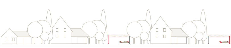
Region A – N1 (W28), Region B – N2 (W33) and Region C – C1 (W41)
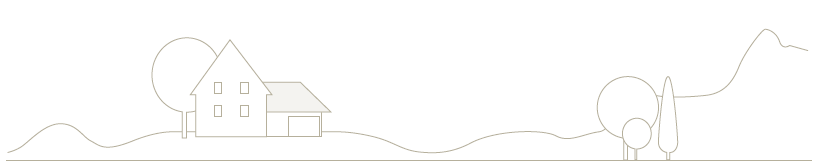
Structure sited in undulating sparsely populated terrain
Region A – N3 (W41), Region B – N4 (W50) and Region C – C3 (W60)

Structures built adjacent to an oval or large vacant lot subject to prevailing winds
Region A – N2 (W33), Region B – N3 (W41) and Region C – C2 (W50)

The first row of buildings adjacent to the sea front
Region A – N3 (W41) Region B – N4 (W50) and Region C – C3 (W60)
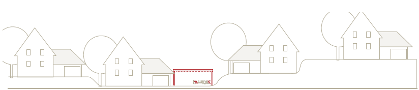
Structures on undulating terrain in suburbia
Region A – N2 (W33), Region B – N3 (W41) and Region C – C2 (W50)
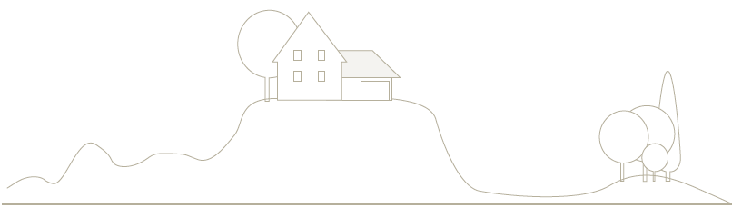
Extremely severe – Isolated building on the crest of a hill
Region A – N4 (W50) Region B – N5 (W60) and Region C – C4 (W70)
